
Source
None.
Today’s Walkers
Neil and Paul.
Start Grid Reference
NY840834
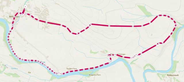
Map of Route
Type of Walk
Village, woodland, riverside, fields and moorland with some historical interest.
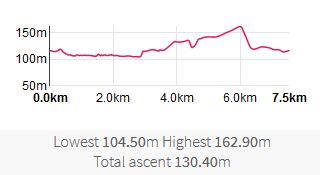
Distance and Time
7.5km / 4¾ miles, 2¾ hours including a stop.
Difficulty
Varying from low alongside the river to medium over the moorland.
Our Rating (up to 5*)
3*
Description
A bonus walk this week with the two ramblers having previously completed other walks. We parked in Bellingham at the car park normally associated with those wanting to walk to see the spectacular waterfalls at Hareshaw Linn. After a brief bit of ‘business’ at the Post Office, we headed towards the river North Tyne and picked up PROW 505/016. This took us southeast along the riverside and afforded some lovely views.


In places, due to recent rain, the path was a little muddy and slippy albeit passable, although one of us nearly suffered an ‘incident’, narrow avoiding coming a ‘cropper’ but with a well defined skid mark. The gentle terrain was easy to navigate and the path was well marked. Passing by the local ‘beach’ we continued on the path until reaching Carlton House where we turned right and headed onto PROW 505/022.
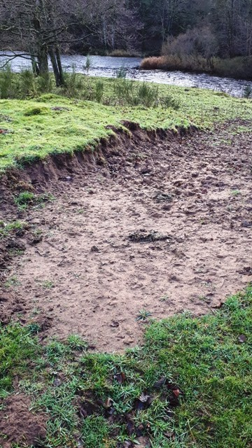
The Bellingham ‘beach’
Following this track led us to a tricky section just before the route took a sharp turn left up a steep(ish) hill. Heavy rain during the week prior to the walk meant that mud was very much present and picking our way through it carefully was the order of the day. Needless to say we succeeded, this being the worst of the walking conditions.
At the junction with the Redesmouth road we turned right and headed along it for a short distance. Quickly after passing under the bridge for the former Border Counties Railway line, we turned left and took our morning break whilst perched on a stile at the start of PROW 505/023. Refreshments completed, we headed up the hill. From this point on, and for the rest of the walk, signposting of the PROWs was very poor and we frequently made use of digital technology to ensure we were on the right path. We passed around the northern side of an [iron age] settlement noting that its double ditches could still be seen. At the prominence overlooking Rede Bridge we stopped to admire the view:

Originally we had planned to walk down to the bridge but due to the steepness of the terrain, and one of us being rather nervous about taking a tumble, we instead turned left onto PROW 505/024. As this route was not marked at all we deviated left and right before eventually picking up PROW 505/025. Evidence of former ‘traffic’ having died (presumably due to the lack of signage on the route) could be seen:

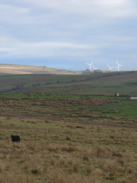
Stopping around the area marked on the map as Callister’s Well, we discussed water and power arrangements before turning round to admire the view.

Shortcutting the official path, again due to lack of signage, we traversed down the steep hill, crossing over the track bed of the disused railway, before turning right and heading along the road back to Bellingham. Brief interest was taken in a old railway underpass before heading into the town.

Somewhat to our surprise, we found ourselves in the ‘Capital of the North Tyne’. We immediately questioned the value of the alleged sponsorship deal.

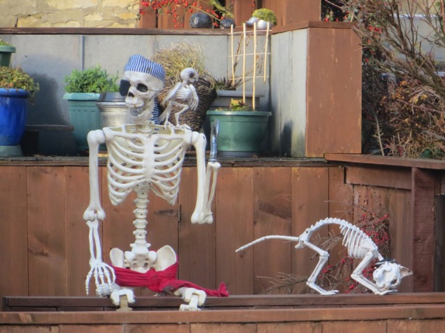
Finally, we turned back up towards the car park passing by a couple of locals who looked like they could do with a hearty meal.
Post walk addendum: Having dropped our goods and shackles off at the car, we headed back into the town and made our way to the Fountain Cottage Cafe and Team Room. Lunch was promptly ordered, consumed and paid for, evidence of the ‘before’ and ‘after’ plates being shown below. Very friendly staff served us and it was disappointing to learn that the cafe was going to close in December 2018. This is due to the local council selling the building to a new owner who did not want to retain the cafe.


