
Type of Walk
Boggy fells, minor (Roman) roads and tracks.
Distance and Time
5.6 miles in 3 hours, with 2 short breaks.
Starting Location
NY789661
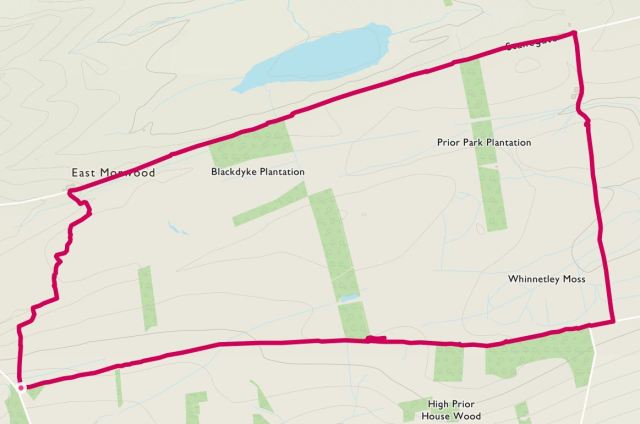
Map of Route and Elevation Profile
Difficulty
Hard for the first ¾ mile but then easy afterwards.
Walking the Route
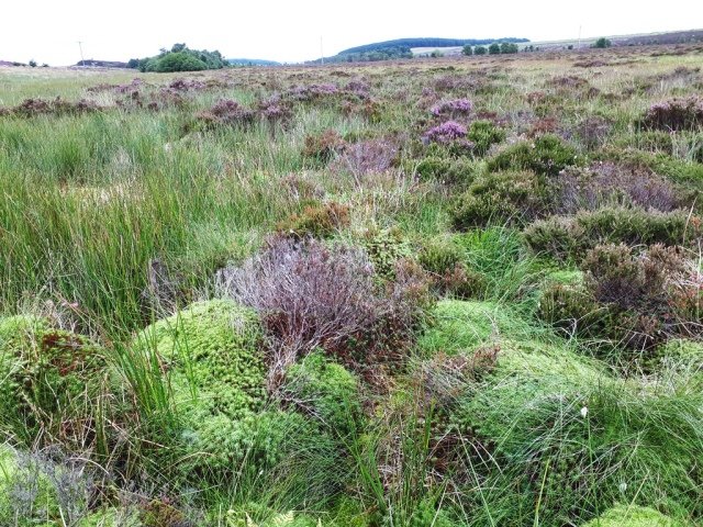
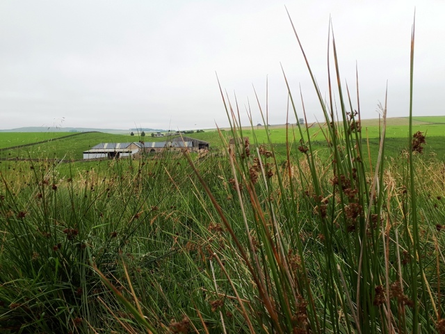
So this was supposed to be an easy walk, and in the main, it was. We parked at a very convenient area of hard ground next to the old Haresby Road, now just a track. Setting off in a north-westerly direction, we followed the very badly marked path 503/004. You will see from the map of the route that we had to criss-cross the fellside, steep as it was in places, and very boggy with huge tussocks (see top image) and deep ditches.


It took an hour just to cover the first ¾ mile; one of the party cursing for the vast majority of the time! It certainly felt like a longer stretch.
Reaching the farm at West Morwood, we turned right and headed along the ancient Stanegate Road. Walking in an easterly direction, we imaged ourselves being back in the first century AD, building and using the road, suitably dressed in our military attire. Although very straight, there’s nothing obvious now that it was Roman Road; no walls, no ditches, no discarded chariots. At least we were now on a tarmac road and good progress was made. Scenic views were noted, well as much as we could see with the low cloud. An obvious feature is Grindon Lough, the smallest and shallowest of the four natural loughs located in the Hadrian’s Wall area.
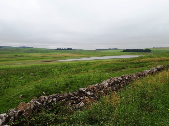
Grindon Lough
Having completely forgotten to look for the remains of a Roman fortlet, we turned right off the road and headed up path 520/006. Here we passed through an interestingly named farm – Seldom Seen. Just past the farm we stopped for a very brief drinks break and soaked up the atmosphere.
Looking back towards Seldom Seen
Once more on the move, we crossed the final part of Whinnetley Moss before arriving at the junction with Haresby Road. There is an intersection of several bridleways and paths here:


We turned right and headed along bridleway 503/047, this being a direct route back to our starting point.
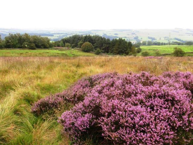
Heather in full bloom
We briefly stopped for lunch, sitting on an old log and broken fences, before completing the circular route.
Our Ratings of the Walk (up to 5*)
- Scenery: 2½*
- Historical interest: 1*
- Weather factor: 2*
- Overall enjoyment: 2½*
Reference(s)
None.
Additional Information
- Walking the route: Neil and Paul
- Weather conditions on the day: Warm but completely overcast.
- Date of walk: 15th August 2020

That looked quite uneven going, but interesting history.
Think Paul would definitely agree with you on that one!