
Source
“Walking the Northumberland Dales” by Jennifer Norderhaug and Barbara Thompson.
Today’s Walkers
Neil and Paul.
Start Grid Reference
NY817551
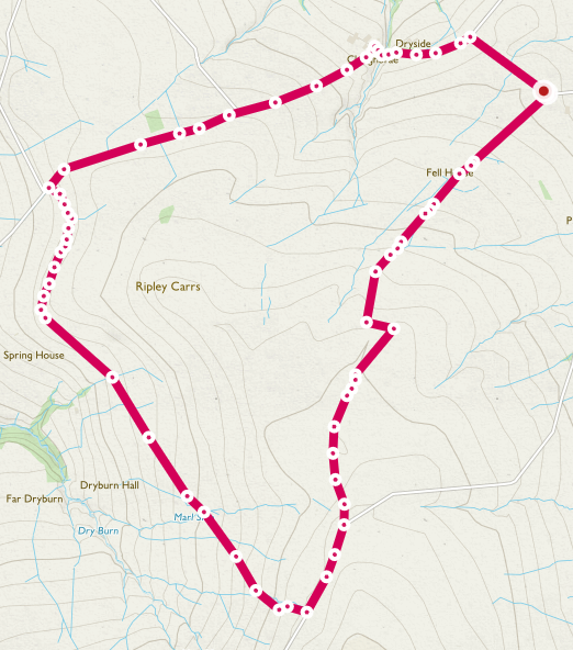
Map of Route
Type of Walk
Moor, views and historical interest.
Distance and Time
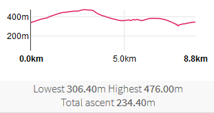
9km / 5½ miles, 3½ hours.
Difficulty
Low to medium.
Our Rating (up to 5*)
4½*
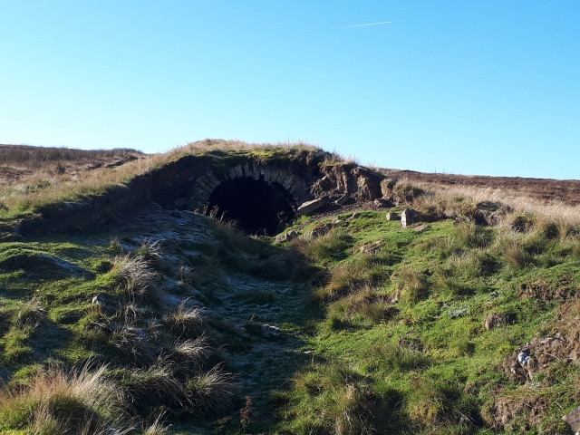
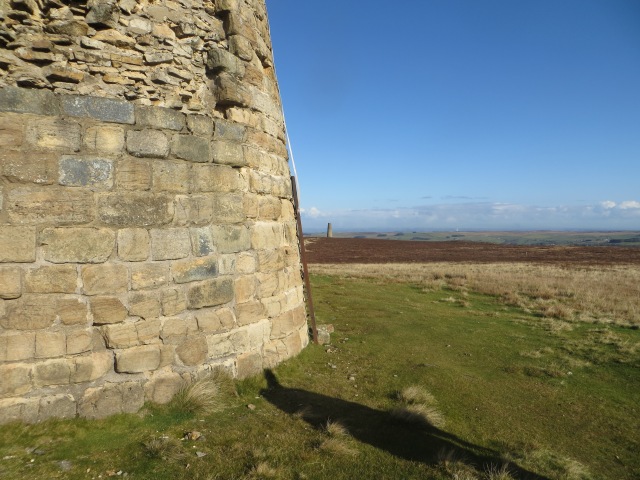
The Chimneys
Before starting the description of the walk here is a little about the chimneys. Although lead mining had been going on in this area since the 17th Century, it peaked in the first half of the 19th Century. The mill for turning ore into lead was at Thornley Gate, just north of Allendale, but flues 2 miles long led SW to 2 chimneys. This was not primarily to take the noxious and harmful fumes away from the mill (though I’m sure that was welcome), but to allow the vapour containing lead and silver to condense on the flue walls. This could then be scraped off and recovered. The system seem to have been through a few versions; presumably it took more than one go to arrive at an efficient design. Both chimneys were originally taller, both having been repaired. For more information see:
https://historicengland.org.uk/listing/the-list/list-entry/1016817
Description
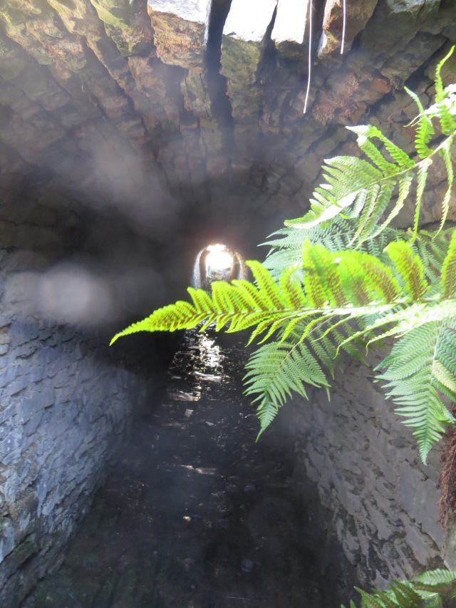
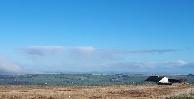
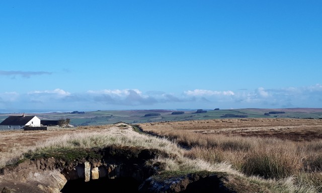
This walk was done on a clear but cold day. Having parked on the verge, as soon as we started walking we could see the first destination, the more northern of the 2 chimneys. We walked up the track leading towards the first chimney (PROW 502/128). At Fell House the track met the northernmost of the 2 flues and as there are collapsed sections we took the chance to walk a little way into the flue (there is just standing room). We were very careful not to knock the stones, and given the condition of the tunnel it looks like further collapses can’t be ruled out. Given the condition I would certainly recommend that nobody walks on top of the flues.
The track follows the route of the Carriers’ Way, used to carry lead ore to the Mill, and runs next to the northernmost flue, running straight to the second chimney. We therefore diverged from it to reach the nearest chimney. There is a nice stone seat next to it, on which we sat for a cup of tea and to look at the wonderful view. It was extremely peaceful; normally there is more birdsong on the moors but at this time of the year I guess many are sunning themselves in Spain and North Africa, the lucky things.
Once we started feeling chilly it was time to move on.

We followed the path of the flue to the second chimney and crawled inside for a quick look.


A look back
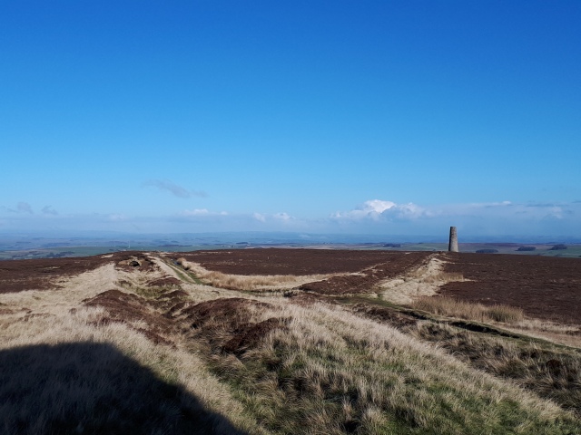
After leaving the second chimney we continued south, gently ascending, past an information board, until reaching a road, where we turned right along a path running next to the road.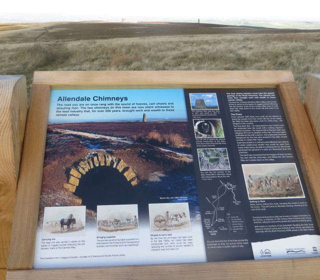
After about 500 yards we turned NW away from the road down 549/025, which drops down across Dryburn Moor. We follow the marker posts for about a mile, after which the route becomes more of a track (549/035), We passed a small ruined house which was the home of Francis Swindle, who, after being rejected as a trainee preacher by the Wesleyan Methodists, founded a small and short-lived sect called the Bochimites. The building was also their meeting house. Just past here, near a gate, we had lunch.
Carrying on, the track seemed to be approaching a road, but then turned right to run NE, parallel to it, then turned left again to meet the road almost at a road junction. Joining the road, we turned right. Following the road for a mile brought us to Hawksteel, where the road twists right to cross Hawksteel Burn. Turning right at the next junction brought us back to the car, but not before looking at the flue entrance and information board nearby.
Probably the best walk so far, with great views, fine (if cold) weather, and lots to look at.
