
Source
Previous experience of area, but mostly created on the day.
Today’s Walkers
Ed and Neil.
Start Grid Reference and Walk Direction
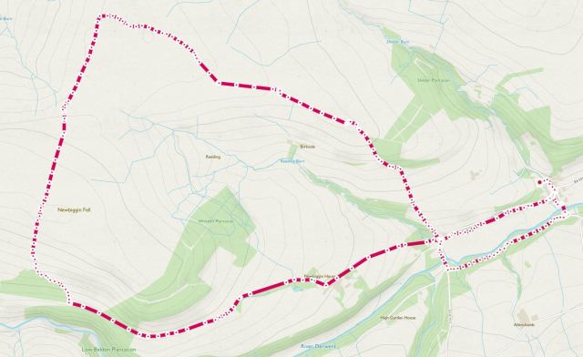
NY965504, clockwise around the figure-of-eight.
Map of Route
Type of Walk
Moorland, lanes and some footpaths.
Distance and Time
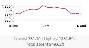
6.4 miles. A fraction over 3 hours, including a break for lunch.
Difficulty
Easy to moderate with some very steep climbs in places.
Our Rating (up to 5*)
1½*, mainly due to the damp cold day.
Description
On a damp, cloudy Bank Holiday Monday, we parked at the public parking area to the Northwest of the village; indeed the same car park we had used on a previous walk (see 29th August 2018. Blanchland Moor and Slaley Forest.) This walk would take lead us through both parts of Northumberland and Durham, noting that path references for routes close to the river Derwent are not available.
Upon leaving the car park, we turned right and headed down into the village, passing the White Monk Tea Rooms on our left. Turning right once more, we walked along Clap Shaw before exiting left, through the recreation ground, onto an unmarked track. Along this route we noted some lovely spring bluebells.


At Baybridge, we crossed Clap Shaw and headed up footpath 507/014. This is a metaled road as far as Newbiggin House. Whilst it was a reasonably challenging climb, it was made slightly worse by the sleeting rain coming down. We followed this track for some distance. Ideally we were looking to take path 507/013 down to the river Derwent, but we did not see any markings for this route. Instead we carried on along the bleak damp track until reaching an unmarked track just north of Castleberry Cleugh.
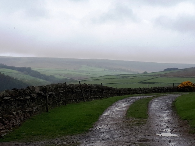
The damp track and low cloud hanging over the valley on a cold Spring day
At this point we turned right and headed up the unnamed track; a very steep hill. However, the higher we climbed the better the views, despite the weather.
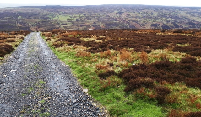
Looking back down the hill on our ascent up the unnamed track
Passing by a series of Grouse Butts, and having [accidentally] scared a few grouse ourselves along the way, we decided to stop for lunch at Blackburn Head. Here there is a welcome hut used mainly for those involved in grouse shooting. For us, it was the most luxurious sight to have a dry lunch on a cold, damp day.
We had just finished our lunch when a party of around 20 walkers from the Haltwhistle Ramblers association took over the accommodation from us. With a cheery hello and goodbye, we left and turned right following clearly signed, bridleway 525/092. The weather had cheered up a little bit by this time affording us some pleasant views to the north.


At the top of Birkside Fell, we turned right onto bridleway 507/012, heading towards Stothill Plantation. At the gas pumping station we turned right and headed down the hill, a rather steep descent on a metaled track. We arrived back at Baybridge and, this time, we crossed the bridge from Northumberland into County Durham, admiring the easterly view of the river Derwent.
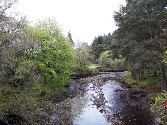
River Derwent looking east from Baybridge
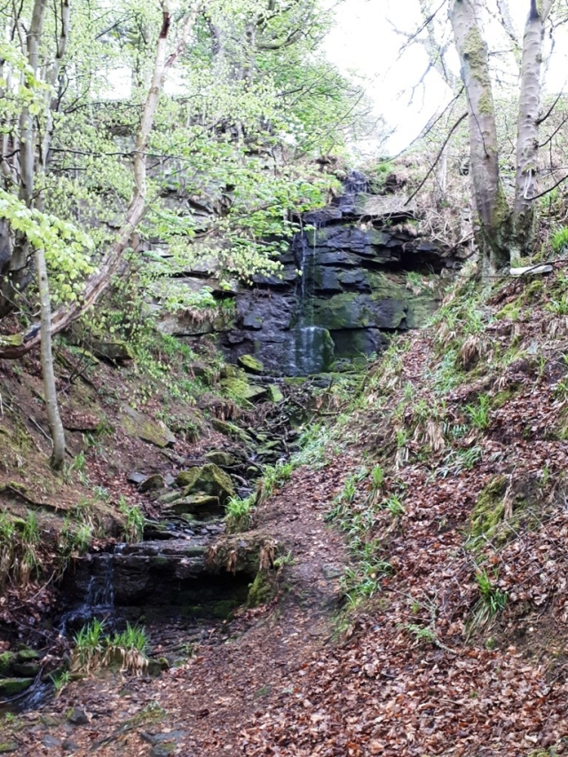
Just after the bridge, we turned left onto a forest footpath and followed it until we arrived back the bridge over the river at Blanchland. Along the way we stopped to admire a small waterfall.
Finally, having crossed the bridge, we walked back up the road to the car park. This was now very full of cars, ostensibly with an influx of elderly patrons visiting the tea rooms. On a summer’s day this would have been a pleasant walk; in the wet and with low cloud it was spoiled just a little.
