
Source
None.
Today’s Walkers
Neil and Paul.
Start Grid Reference
NY989643
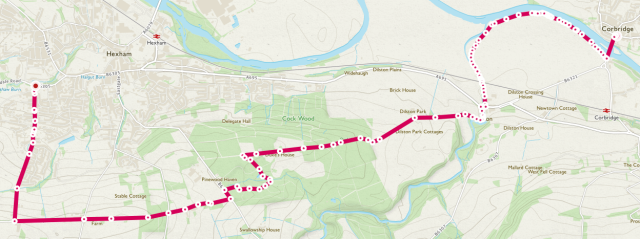
Map of Route
Type of Walk
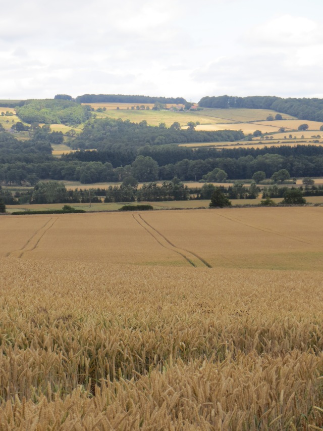
Riverside, fields, woodland and views.
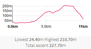
Distance and Time
11km / 7 miles, 3 hours.
Difficulty
Low to medium (easy to navigate but the longest and with the most ascent so far).
Our rating (up to 5*)
3½*
Description
This was a one-way walk, started by taking the bus from Hexham to Corbridge.
We crossed the attractive 17th bridge to the south bank of the Tyne, and headed west along the footpath next to the river. If you have access to the NCC Public Rights of Way map (http://map.northumberland.gov.uk/prow/) this is Reference 513/043. A short way along we passed the Roman bridge abutment which was part of the bridge that carried Dere Street across the Tyne. The abutment was dismantled and rebuilt further away from the river in 2004 because of the threat from erosion.
After walking about a mile, at Devil’s Water the path leads away from the river towards Dilston. We crossed the railway line and the A695 then followed signs to Dilston Physic Garden. Ignoring the garden entrance we carried on up the path (now 513/015). Following this path WSW gives a steady but (mostly) gentle climb past fields.
We then continued along the path into the wood and found a good place to sit on a log and have a restorative cup of tea or a cold drink. The next few hundred yards though woodland was harder walking and the route less clear, but with interesting (and overgrown) old walls, gates and tracks. Heading West took us to a metalled track (524/041) past the back of Duke’s House, with its impressive array of chimneys. Following that track West, about a mile after entering the wood we came out on the B6306. A short but steep climb led to the Yarridge Road (aka Racecourse Road) which we followed West. The first mile is a steady climb, but worth it for the views North over the Tyne Valley. After another ½ mile or so we turned down Causey Hill Road for the steep descent to the end.
